Bill's Biography
I
have been creating/updating maps ever since I started orienteering 37
years ago. It became a "hobjob" about 10 years ago when I escaped the
IT rat race to enjoy, among other things, this fine art called
cartography. Without any formal education in the art, I switched the
name of my IT company and jumped into the map-making business. My
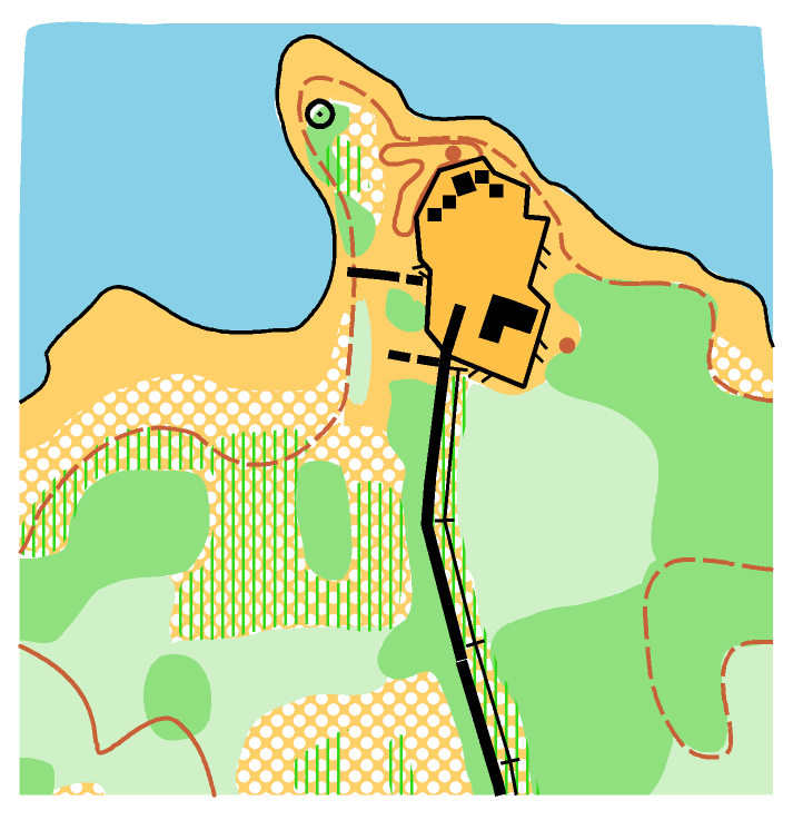
first formal contract was with National Defense for an orienteering map
of one of their training areas near Ottawa - where I still live. It's a restricted area so all I can show you is a sample. : )
Since
then, I have worked on dozens of local maps for "A" and "B" meets as
well as many maps for other clubs outside the Ottawa area. Major
projects include maps for two recent Canadian Championships in New Brunswick and Ottawa.
Despite all the
advances in technology, creating maps for orienteers (the two-dimensional paper-based kind) is still very much
a traditional "craft" and not a high-tech process. Lots of outdoor legwork/eye work/brain work with a great deal
of room for interpretation, generalization, and freedom of
expression. I like that.Traveling
to undiscovered parts of this beautiful country - as well as other
parts of this world - has always been an important aspect of
my orienteering experience. Every new meet is a "destination
event". Likewise for mapping. I have worked in only two countries and
three provinces so far but I will be reaching out for more.
Getting
more orienteers involved with mapping has been a goal of mine over the
last few years. As such, I have been conducting training workshops
for new mappers. I have linked the curriculum I have used on the main page menu. After 10 years I am still learning - lots!
Cheers, Bill Anderson